

Unified Geohazard Intelligence Platform
Advancing the state-of-the-art in geohazard assessment and risk intelligence for mission-critical applications.
Mission-FirstGeohazard Intelligence
Designed specifically for the Department of War and critical infrastructure stakeholders, GeoLogix.ai is a cutting-edge geohazard assessment platform. Built on advanced geospatial intelligence and machine learning, GeoLogix provides unified, actionable insights into seismic risks, fault line mapping, wildfire threats, and other critical geohazards that could impact mission operations and asset protection.
Post-competitive and ready for rapid procurement without further competition.

Advancing Geohazard Intelligence
Empower geotechnical engineers and infrastructure specialists with the most advanced, intelligent geohazard assessment platform—enabling faster, safer, and smarter decisions that protect communities and critical infrastructure.

Innovation First
Continuously advancing AI and machine learning algorithms to predict geohazards with unprecedented accuracy and speed. We invest in cutting-edge research and development to stay at the forefront of geotechnical intelligence.
Multi-Hazard Coverage
Comprehensive analysis across earthquakes, landslides, subsidence, flooding, volcanic activity, and wildfires. A single unified platform that consolidates 25+ authoritative data sources into actionable intelligence for any terrain or mission environment.
Proven Capability
Reviewed and validated by a panel of DoW subject matter experts and deemed mission-ready for immediate fielding. Our platform meets rigorous government standards and operational requirements.
Help us shape the future of geotechnical intelligence. Your feedback and expertise drive continuous improvements that make GeoLogix the premier platform for geotechnical engineers.
Join The GeoLogix JourneyInteractive GeoLogix Demo
Explore the power of unified geohazard intelligence. The demo below shows real-time monitoring capabilities across multiple hazard types.
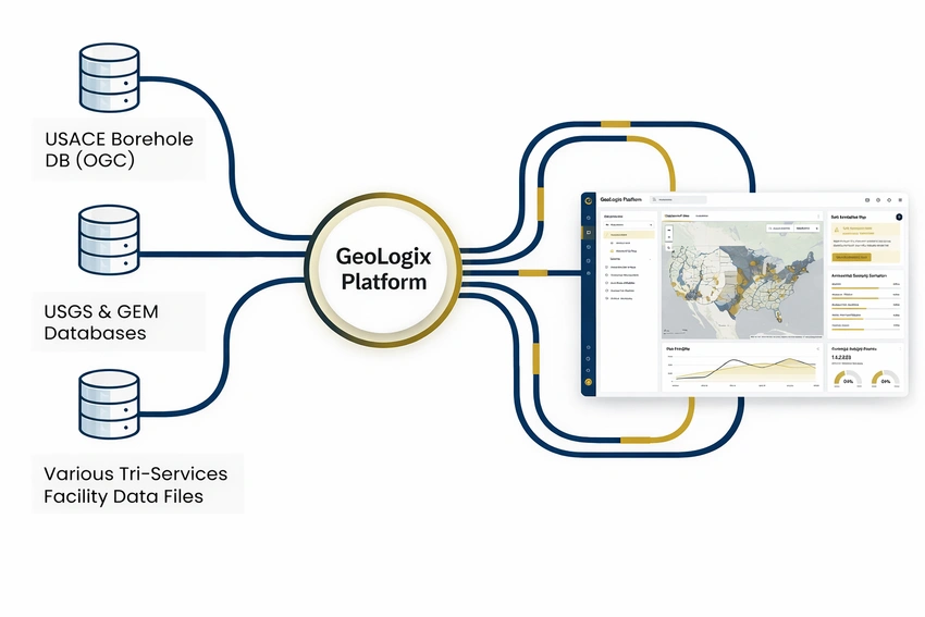
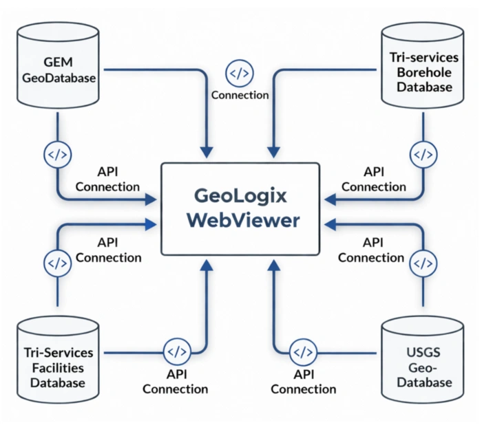
A Single Pane of Glass for Tri-Service Geohazard Intelligence
Unified access to current and future geohazard data sources, with flexible integration for emerging datasets. GeoLogix aggregates and normalizes data from the world's most trusted scientific and governmental agencies
Seismic & Tectonic
Landslide & Subsidence
Geotechnical & Infrastructure
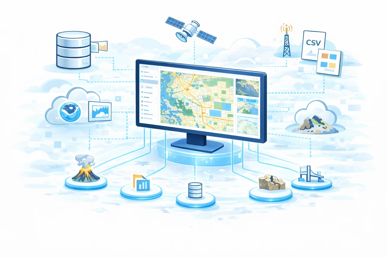
Wildfire & Fire Risk
Weather & Flood
Volcanic Activity
All data sources are continuously updated and validated through automated quality assurance pipelines
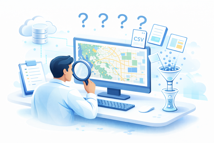
Mission Resilience is Threatened by Data Chaos
The Department of War faces a critical challenge: maintaining military installation resilience against acute geohazards like seismic events. The problem isn't a lack of data—it's quite the opposite.
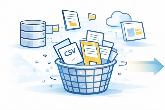
A Puzzle of Data Sources
For decades, the military and government agencies like the USGS have been collecting critical geologic information in their own separate silos—borehole samples, soil tests, fault line locations. The puzzle pieces are scattered everywhere, making the complete picture almost impossible to see.
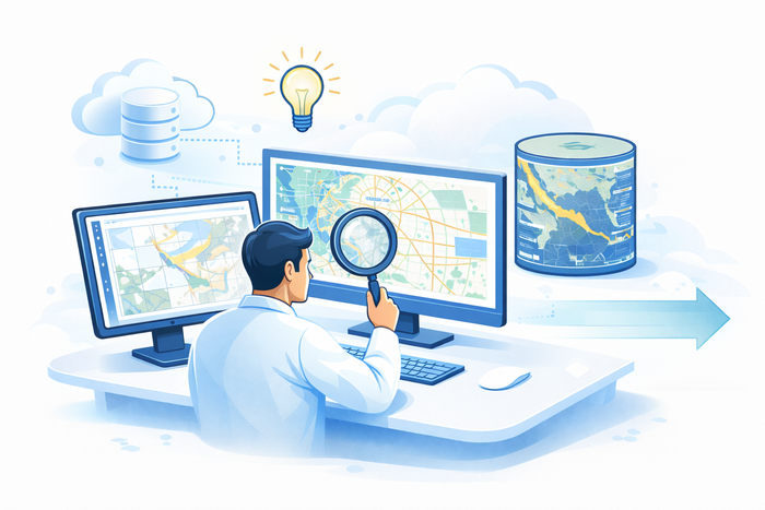
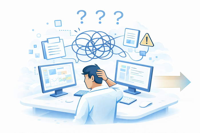
The Analyst's Struggle
To assess the risk for just one location, an analyst must manually pull data from multiple disconnected streams and attempt to merge them together. It's slow, inefficient, and error-prone—critical connections are easily missed, and the resulting analysis is often incomplete.
The Current Manual Process
Hunt Data
Hunt for data across multiple fragmented systems and agencies.
Pull Files
Manually pull and download different file formats from each source.
Combine
Attempt to merge and standardize the data into a coherent format.
Analyze
Analyze what is often an incomplete and unreliable picture.
Siloed Intelligence
Critical geotechnical and seismic data is scattered across disconnected, independent sources, hindering a unified operational picture.
Inefficient Analysis
Analysts spend excessive time locating and correlating data instead of performing high-value risk assessments, causing significant delays.
Increased Mission Risk
Without a holistic view, critical infrastructure at military installations remains vulnerable to geohazard events, jeopardizing mission readiness.
This manual process violates core DoW Data Strategy principles
The DoW Data Strategy mandates that mission-critical data must be Visible, Accessible, Understandable, Linked, Trusted, Interoperable, and Secure. The current fragmented approach fails on nearly every principle—especially Linked and Interoperable.
Why GeoLogix Matters

Advanced Insights
Gain real-time geohazard intelligence that enables strategic decision-making. Access predictive insights to protect operations and critical assets.

Cloud-Powered Collaboration
Access GeoLogix from anywhere, anytime. Seamless real-time collaboration and instant updates across your distributed team.

Reduce Risk & Costs
Identify and mitigate geohazard risks early. Avoid expensive delays, insurance premiums, and catastrophic losses.

Mission Assurance
Ensure critical infrastructure, supply chains, and military operations remain resilient against geohazard threats.
Continuous Evolution
GeoLogix isn't a static product—it's a living, evolving platform. We commit to continuous innovation, regular feature updates, and AI model improvements driven by user feedback and the latest geotechnical research. This is a partnership with our customers, not a one-time deployment. Your investment grows with enhanced capabilities and cutting-edge intelligence delivered regularly.
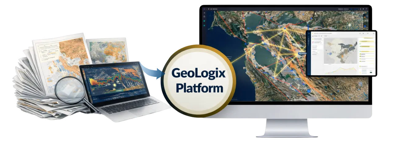
The Future: A Platform Built for Correlation, Not Just Access
GeoLogix replaces the outdated model with an integrated architecture designed to discover relationships between authoritative datasets, rather than forcing engineers to infer them.
Key Capabilities
Unified Environment
A single web-accessible interface built on the USACE Civil Works Business Intelligence (CWBI) cloud environment (AWS GovCloud).
Automated Discovery
A consistent data model and rich metadata create a foundation for discovering non-obvious relationships between data points.
AI as a Force Multiplier
AI is used to structure legacy data and surface complex patterns that are beyond the scope of manual analysis.
Enterprise-Wide Insight
Enables a shift from location-specific interpretation to strategic, data-driven decisions across the enterprise.
Beyond Visualization: In-Platform Analysis & AI Discovery
GeoLogix isn't just a data viewer—it embeds powerful analysis tools directly into the interface while AI surfaces non-obvious correlations beyond the scale of manual analysis.
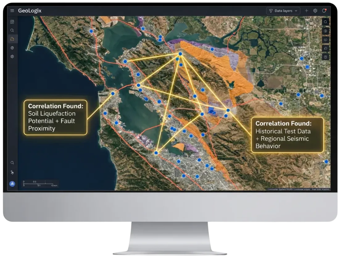
Seismic Hazard Toolbox
Engineers can evaluate risk in context—at the installation, regional, or portfolio level—without ever exporting data.
AI as a Force Multiplier
Machine learning models surface multi-variable correlations:
The Result: A Step Change in Mission Capability
FROM: Reactive & Fragmented
Answering questions about a single location based on an expert's mental model and disconnected tools.
TO: Proactive & Integrated
Making strategic, data-driven decisions based on a system-wide understanding of geohazard risk and mission resilience.
Enabling: Deeper Insight • Better Prioritization • More Informed Decisions
Integrate, Don't Duplicate: Data Stays Authoritative and Secure
GeoLogix is API-first by design, ensuring data is not duplicated. We integrate directly with authoritative sources, ensuring data is always current and secure where it belongs. This makes data Visible, Accessible, Understandable, Linked, Trusted, Interoperable, and Secure (VAULTIS), a fundamental principle of the DoW Data Strategy.
Built for the Mission
Cloud-native, secure architecture ready for rapid deployment across government and commercial environments
Infrastructure-as-Code
- •Automated Deployment
- •Repeatable Instantiation
- •Secure by Design
Security First
- •NIST SP 800-53 Controls
- •End-to-End Encryption
- •Continuous Compliance Monitoring
GovCloud Ready
- •IL2/4 Compliance
- •Deployable to USACE CWBI
- •Minimal Friction Fielding
DevSecOps
- •Rapid Secure Deployment
- •Modern Best Practices
- •Continuous Security
What makes GeoLogix stand out?
Purpose-built for geohazard intelligence—faster to value, easier to integrate, mission-ready
| Feature | ArcGIS-only (Esri) | Data platform + BI | Custom app (mapping SDKs) | General ops/integration platform | Geotech systems (records, boreholes) | Seismic hazard tools (hazard engines, shaking) | GeoLogix |
|---|---|---|---|---|---|---|---|
| Depth for geohazards | ⚠️Strong GIS. Limited geohazard fusion and mission workflows out of the box | ✗Strong data. Weak map-first operational geohazard decisioning | ✓Can be high, but only if you build it | ⚠️Broad. Geohazard depth usually requires tailoring | ✓Excellent geotech records. ✗ Limited enterprise hazard fusion | ✓Excellent hazard science outputs. ✗ Not end-to-end decision workflows | ✓Purpose-built geohazard fusion plus mission impact workflows |
| Time to value | ⚠️Weeks to months (custom build) | ⚠️Months (data engineering plus app layer) | ✗Months to a year | ⚠️Weeks to months | ⚠️Weeks to months (migration and standardization) | ✓Fast for hazard outputs. ⚠️ Slower to operationalize at scale | ✓Faster because workflows are recorded |
| Access/entry | ✓Already in many agencies | ✓Often already funded enterprise-wide | ✓Flexible. Any dev team can start | ⚠️Varies. Often heavyweight onboarding | ⚠️Often program-level, not enterprise | ✓Many are standard or publicly available | ✓Designed for quick evaluation and pilot path |
| Integration effort | ⚠️Medium to high (feeds, models, asset context, governance) | ✗High (geo fusion, alerting, UI, workflows) | ✗Very high (connectors, auth, audit, fusion, workflows) | ⚠️Medium to high (data modeling and operationalization) | ⚠️Medium (not designed as decision hub) | ⚠️Medium to high (asset context, exposure, workflows) | ✓Lower than build-from-scratch. API-first integration with authoritative sources |
| Maintenance burden | ⚠️High (custom apps and pipelines) | ✗High (pipelines plus separate map experience) | ✗Very high (you own product security and sustainment) | ⚠️Medium (platform-managed customization grows) | ⚠️Medium (strong records, weaker ops workflows) | ✓Low to consume outputs. ⚠️ Higher if you build enterprise decisioning | ✓Reduced. Product handles core patterns and updates |
| Evidence and credibility | ⚠️Typically internal. Outcomes depend on build quality | ⚠️Strong reporting. Weak operational proof unless built | ⚠️Depends on delivery maturity | ✓Often strong enterprise adoption, not always geohazard-specific | ✓Strong for compliance and records. Mixed for mission outcomes | ✓Strong scientific credibility. Less enterprise ops outcome proof | ✓Validated by DoW GeoTechnical SMEs |
| Best for | Teams building custom geohazard apps on enterprise GIS | Enterprise reporting and analytics | Unique UX needs where cost is acceptable | Cross-mission ops with many domains | Managing investigations, boreholes, subsurface records | Producing hazard layers, shaking maps, scenarios | ✓Decision-ready geohazard platform without multi-year build |

USACE Civil Works Database Authorization
Solid Logix added granular access control to the U.S. Army Corps of Engineers Civil Works data environment that supports reservoir, dam, lock, and river operations nationwide. Delivered ahead of schedule, with excellent CPARS performance, and no disruption to the live system.
The Tradewinds Advantage for GeoLogix
GeoLogix is awardable on DoW's Tradewinds Marketplace, which means government agencies can contract with us directly—without issuing a new RFP or justifying a Sole Source. This streamlined procurement approach removes traditional barriers and enables rapid deployment of innovative technology to mission-critical applications.
Awardable on Tradewinds Solutions Marketplace
Post-Competitive Procurement Made Simple
GeoLogix has been assessed and deemed Awardable by the DoW's Tradewinds Solutions Marketplace, meaning it has already satisfied competition requirements. Government agencies can now contract directly with Solid Logix for GeoLogix without issuing a new RFP or conducting additional competition.
This "post-competitive" status streamlines procurement, reduces acquisition time from months to weeks, and allows agencies to leverage innovative geohazard intelligence capabilities immediately.


Fast-Track
Accelerated procurement timeline
Pre-Vetted
Solutions meet DoW standards
Flexible Terms
Adapt to mission requirements
Support
Ongoing vendor partnership
Simplified Procurement
About the Tradewinds Program
The Department of War's Tradewinds Solutions Marketplace provides government agencies with streamlined access to innovative solutions without the overhead of traditional acquisition processes.
Validated as a post-competitive, Awardable solution, GeoLogix.ai meets all DoW requirements and is positioned for seamless, rapid procurement.
- Simplified Procurement: Reduced bureaucracy and faster acquisition timelines
- Commercial Solutions: Access to pre-screened, mission-ready capabilities
- Flexible Contracting: Multiple engagement models and contract vehicles
- Government-Compliant: Full compliance with federal requirements and standards

Comparing Acquisition Methods
How to Acquire GeoLogix
Follow these simple steps to leverage GeoLogix for your mission-critical applications.
Create Tradewinds Account
Sign up for the DoW Tradewinds Marketplace using your government email account to access Awardable solutions.
Browse Marketplace
Log into your Tradewinds account and search solutions for "GeoLogix: Unified Geospatial Data Fusion for Seismic and Infrastructure Risk"
Review Solution
View the five minute video overview explaining the product, including the pricing model. You are able to see the feedback from the review panel and can also provide your own feedback.
Contact Solid Logix
Reach out to discuss licensing options, pilot programs, and implementation timelines, or any custom requirements your agency might have.
Execute Contract
Finalize terms, establish service-level agreements, and commence deployment of GeoLogix within your agency's cloud infrastructure.